Blueprint (layout change)
Revealing our genetic makeup
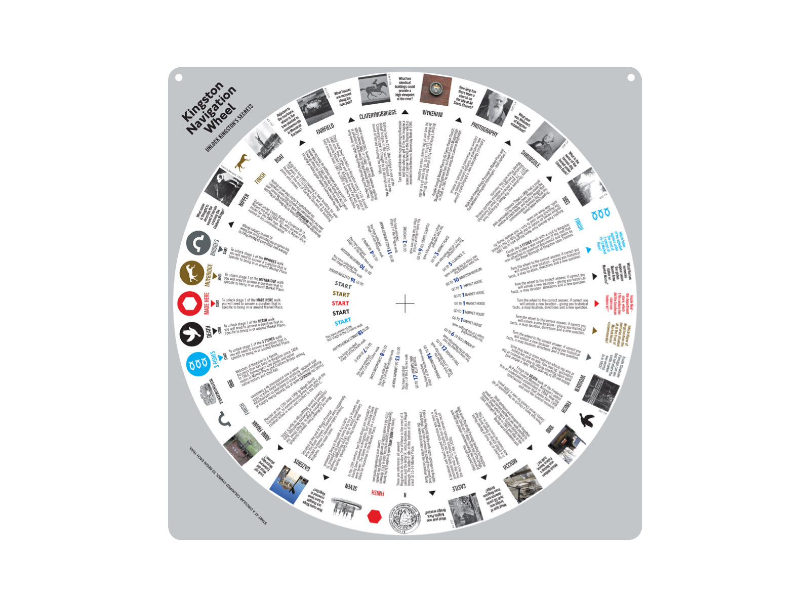
Kingston Navigation Wheel
by Gian Luca Amadei
Published in Blueprint, January 2013
A design project has uncovered the ‘hidden’ history of a London borough through its key geographical, historical and cultural landmarks by reviving a navigation system that has been around for centuries.

The way in which we navigate urban spaces has changed dramatically in recent years, moving quickly from analogue world maps to handy digital devices using the Global Positioning System (GPS), which are accessible on demand.
But despite their precision and relatively easy access and use, digital devices can quickly become obsolete if not regularly updated. In this respect traditional maps have a longer shelf life than their digital counterpart and, one could argue, have an haptic quality that digital devices do not feature. Partly moved by the dilemma of the digital versus the analogue, Brighton-based design practice Studio Tonne revisited the principles of the volvelle, or wheel chart.
Mostly found in ancient astronomy books, these calculation tools are formed by overlapping two rotating disk on a pivot. To this day this low-tech tool is also known as a planisphere, and is mostly used for learning how to recognise stars and constellations.
Just as a planisphere keeps stargazers and planet-spotters’ eyes up and their hands tightly gripped to this paper-made steering wheel, so the Kingston Navigation Wheel keeps its users’ eyes fixed on to buildings, alleys and pavements to spot any sign of Kingston upon Thames’ hidden history.
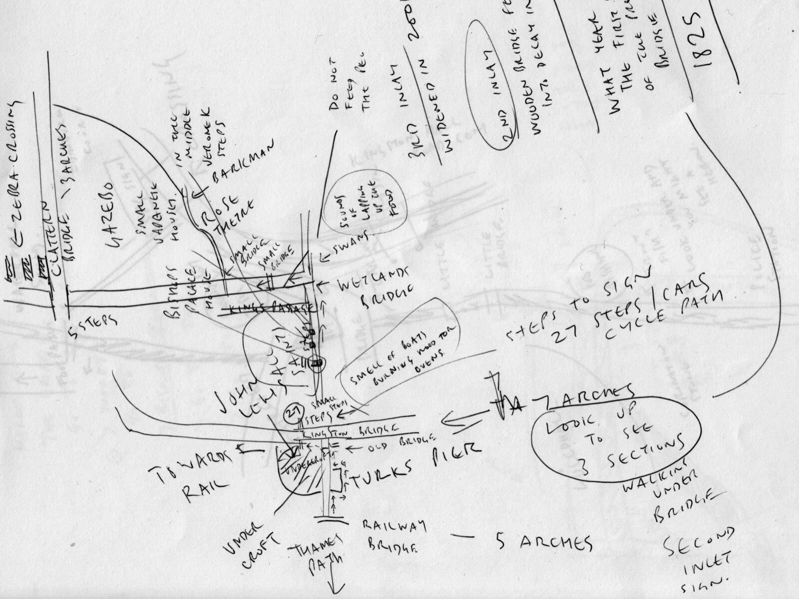
One of the early sketched maps in which Farringdon started to note some of the details, symbols, buildings and even smells around Kingston
The aim of the project is to encourage visitors entering Kingston via its main ‘gateways’, such as the railway station, to explore areas away from the main retail centre (the Bentall Centre) and to uncover the hidden Kingston through its key geographical, historical and cultural landmarks.
Paul Farrington, founder of Studio Tonne, is not new to projects such as the Kingston Navigation Wheel that cross the boundaries between graphic and interactive design. In recent years Farringdon’s practice has handled an eclectic mix of projects, from sound toys to furniture. Farrington’s own curiosity for design objects and architectural and social history formed the basis for the painstaking research he conducted in preparation for the Kingston Navigation Wheel project.
‘Ever since I can remember I have collected ephemera – handwritten signs, letterpress blocks, rulers and so on,’ says Farrington. ‘These objects remind me of a time when design was made by hand and I have always enjoyed collecting them, not knowing what use they would have other than looking nice.’ The Kingston Navigation Wheel project was inspired by the Surrey Walking Club and the Victorian sport of pedestrianism, and stemmed from two parallel projects.
The first was a commission by the Stanley Picker Gallery in Kingston, entitled No Competition!, which consisted in an off-site programme of artist projects exploring the relationship between art and non-competitive sport. Farrington was one of three artists who were commissioned and he was asked to research the theme of walking as non-competitive sport. The other was a commission by the Royal Borough of Kingston’s Outer London Fund to suggest design ideas that would allow people to navigate and explore aspects of Kingston, as well as access information that would provide an alternate view of the area.

No Competition! badge emblem
Design: Paul Farrington
‘I had visited Kingston many times but my journey had always consisted of just walking from the train station to Kingston University, and to be honest the walk itself was not very inspiring. So when I began the project I really had no idea what sort of place Kingston actually was – all I knew was that people liked to go shopping and that was about it’, Farrington says.
After a few exploratory walks in the area Farrington realised that Kingston did not have any consistent signage, making navigation of the area confusing for people. He embarked on a study of signage that allowed him to locate and document the range of existing community noticeboards and signage devices in the town centre, both fixed and semi-permanent, that could inform him of the direction to take, rather than simply follow the flow of people moving from the train station to the Bentall Centre.
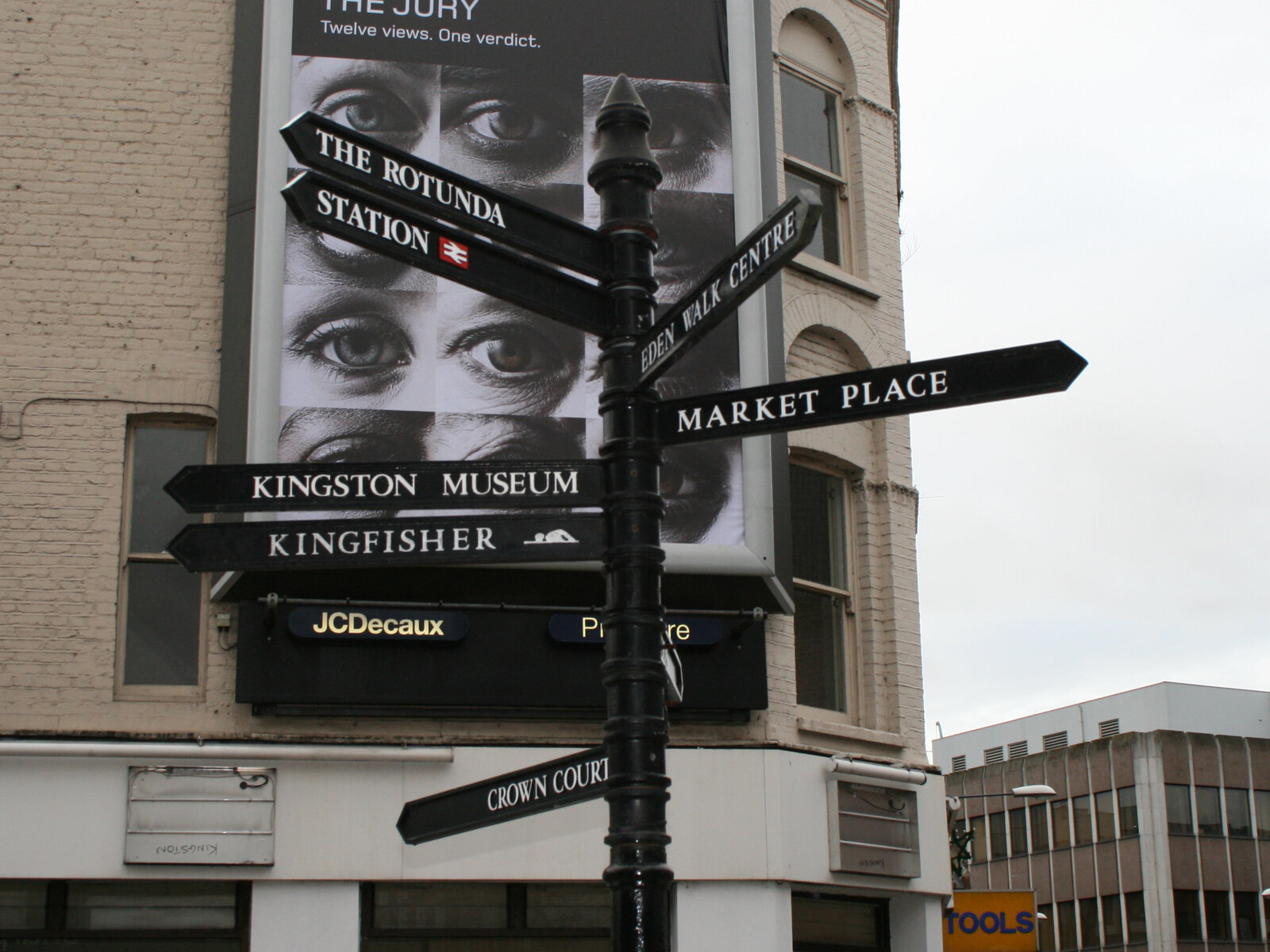
The first step in Paul Farrington’s research was to carry out a survey of the existing navigation tools in Kingston to map their location, relevance and effectiveness

Research. Pedestrianism, Three fishes emblem, Kingston map.
‘As this project used walking as a theme, I began researching the historical representations of walking – scientific, artistic, medical – and became interested in the Victorian sport of pedestrianism, now known as race walking. From race walking I became interested in the methods and rules used in the sport for orienteering,’ explains Farrington.
By studying the routes into Kingston followed and the information collected on them, various themes started to emerge and develop, and eventually formed five distinct walks. ‘For instance, wherever I walked I would see a crest of three fish – on the side of bridges, shops and roads – and by diving into the archives at Kingston Museum I found out that these fish relate to how Kingston used to have three salmon fisheries in the Thames, as recorded in 1086 the Doomsday Book,’ says Farrington.
He also conducted research into the range of devices needed when walking, such as compasses, maps, walking sticks, shoes, notebooks, binoculars and iPhone apps. As the research material started to reach a critical mass Farrington also started to question how would people actually start a walk and where would they finish.

Transcribed audio walk

Intrigued by the way in which orienteering devices work, he decided that people had to answer questions relating to the spaces they were to start at and move through in their walks around Kingston. This defined the final design of the wheel which, although very technical in its early prototypes, in its final version reached a balance between the amount of information made available and its accessibility to users.

The revolving disk shows a map of the area and locations around Kingston. During each walk the user is asked questions to unlock the next landmark to visit
The bottom disk of the wheel, containing all the historical data uncovered on Kingston during research by Farrington on Kingston, giving a different perspective of the area
‘At the end of my research,’ says Farrington, ‘my perception of Kingston had changed dramatically. I became very excited that Kingston had so much history, which was hidden away down alleyways, inside department stores, above computer shops, under bridges, behind buildings, in gardens and parks, floating in the river, inside books in records offices, in museums and art galleries, churches, perfume shops, in the sky, below bank vaults and hidden in funeral parlours.’
The rich tapestry of history that Farrington uncovered in just one relatively small part of London is also telling of how little urban history is accessible on demand, and how much more there is to be researched, revealed and communicated – whether by analogue or digital navigation devices.
See more

Science Illustration